LATEST PROJECTS
Project | 01 Forks Tourist Map
The objective of the assignment was to create a tourist map of The Forks that allows the reader to see all the attractions The Forks has to offer, and how to get to each attraction. The map needed to be simple and easy to navigate, so that it could be effective in conveying its information to a reader, who may have no prior knowledge about The Forks.
This is the project that won me the ESRI Canada GIS Scholarship. For more information on the scholarship, click here.
Project | 02 Federal Election Map
The objective of the assignment was to create a poster with information pertaining to the 2015 Canadian federal election for my home riding. The purpose being that anyone in the riding requiring more information on how to vote could find it, as well as information on the candidates and the riding itself.
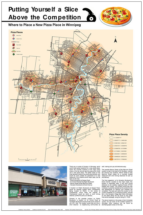
Project | 03 Pizza Locations
The objective of the assignment was to create an address locator, and use it to locate big pizza chain locations in winnipeg, and map them. The locations were then used to create a heat map, allowing for potential spots for a new pizza place to be identified.
Click here for an embedded map version of the pizza locations.
To see more or discuss possible work let's talk >>